A conditions assessment documenting material performance, tree health, soil, irrigation, and maintenance needs along MIT's Vassar Street. I conducted the field research and analysis and developed the report's maps, diagrams, visual assessment system, and recommendations.
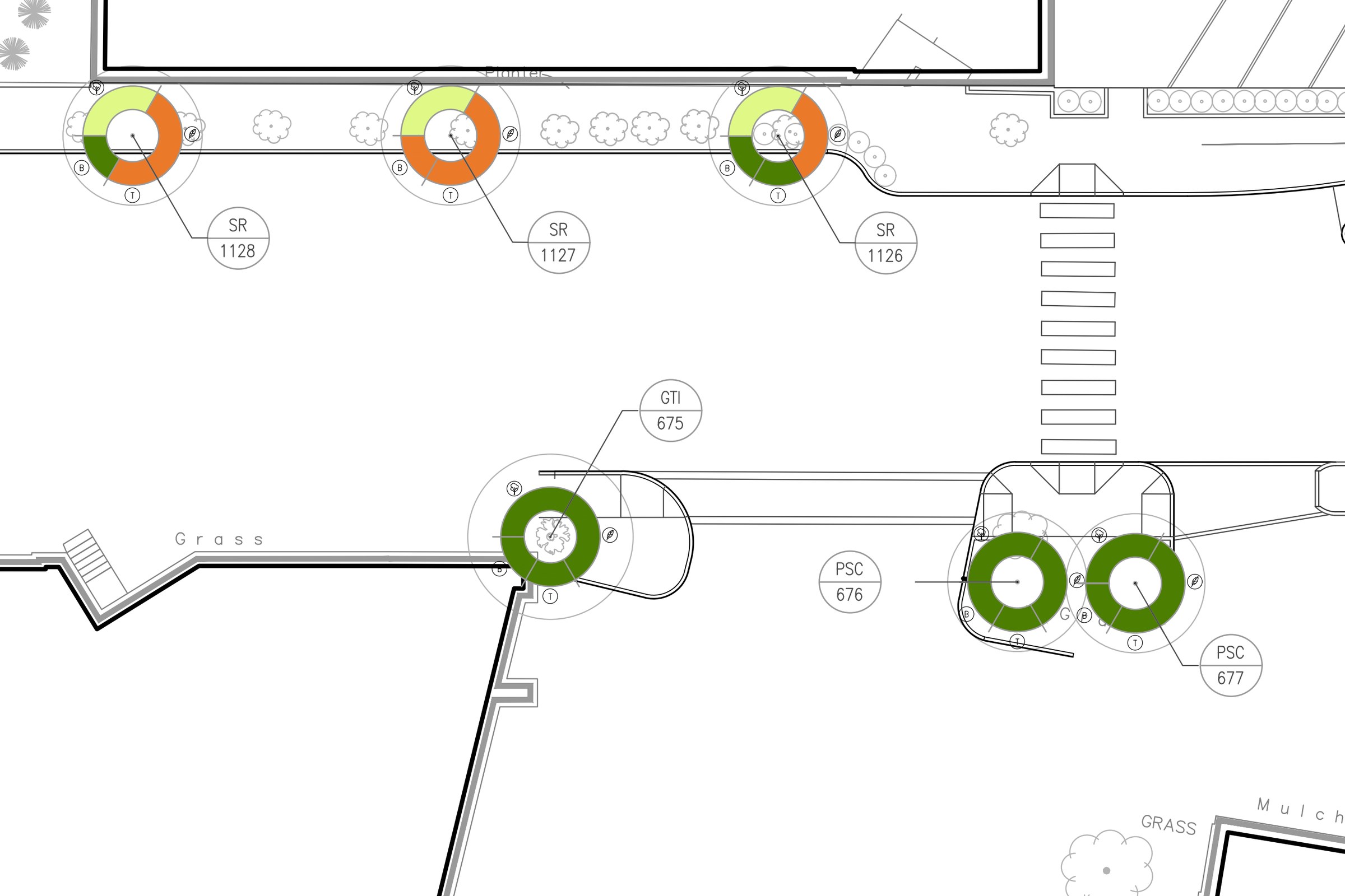
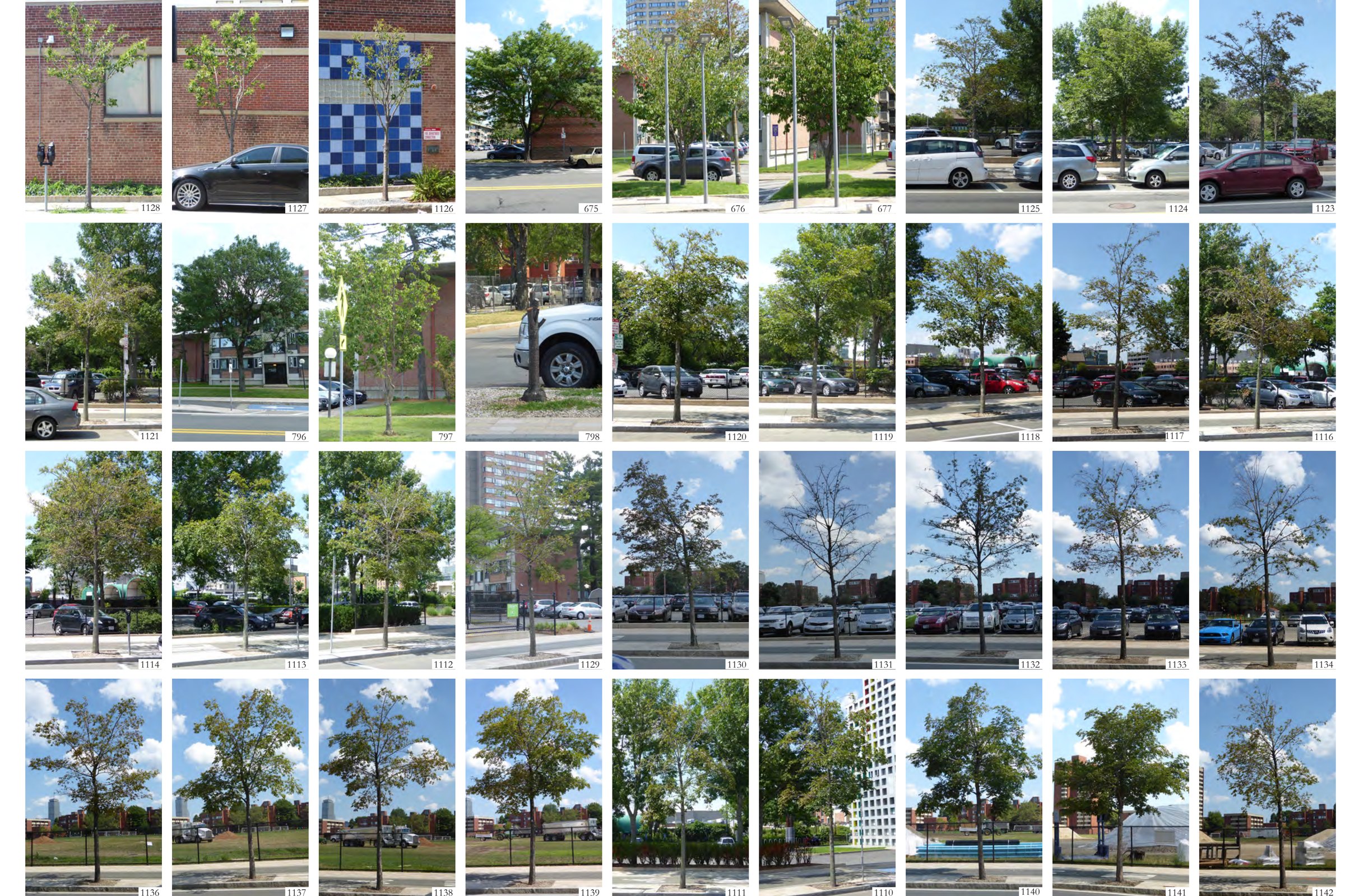
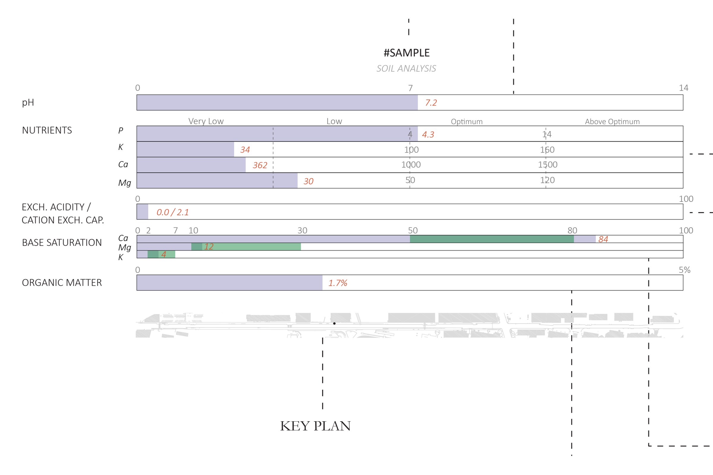
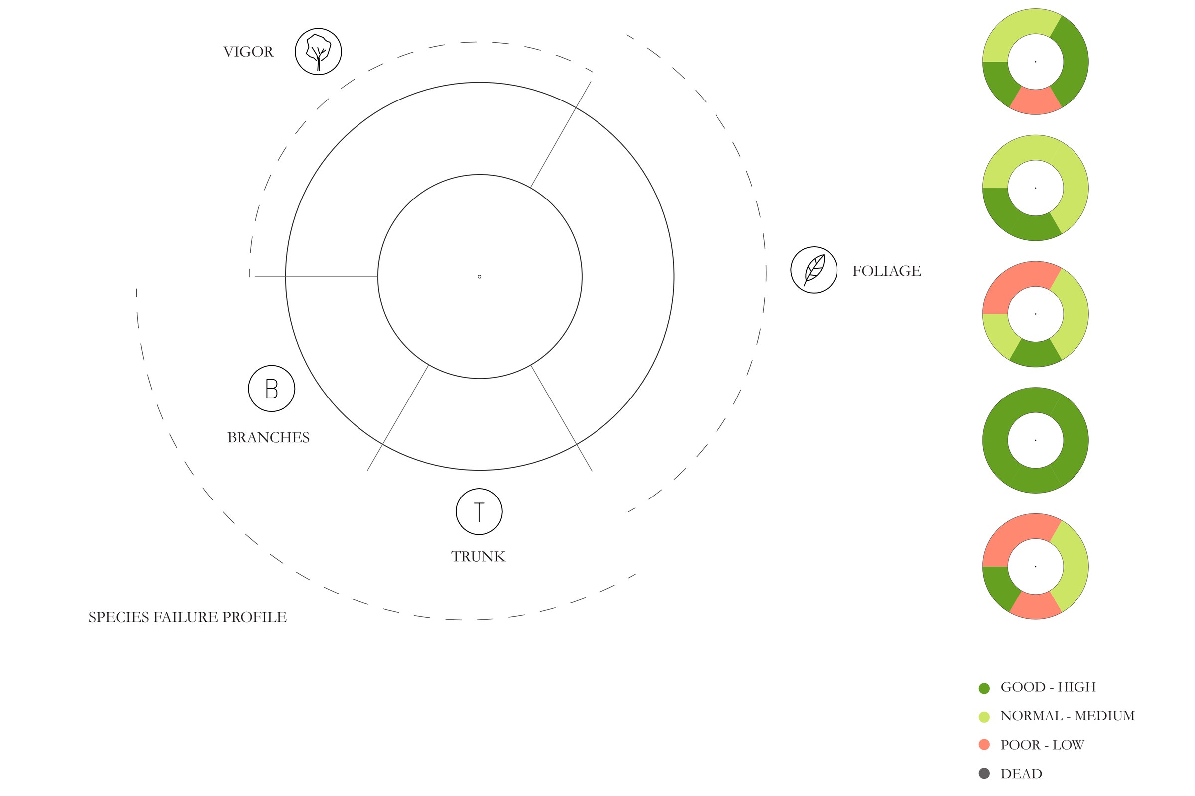
The street was surveyed tree by tree and block by block, on foot, over one summer. Each tree was rated on vigor, foliage, and its species' known failure profile, using the International Society of Arboriculture's basic assessment form, and the rating was drawn as a ring so the whole street could be read at a glance on the record drawings. Site materials, irrigation zones, and soil were mapped as separate layers with the same numbering, so a condition in a photo could be found on the plan and in the recommendations.
The report gave MIT's Office of Campus Planning a documented baseline for paving, furnishings, lighting, planting, and irrigation repairs on Vassar Street. It continued to be referenced by MIT planning staff a decade later.